Eleven stops, three weeks and a lot of red dirt: the full route from Antananarivo to the Grand Tsingy, with honest drive times, costs and lessons learned.
Madagascar is not your average road trip. It's closer to an expedition, where the journey matters as much as the destination. Travel vloggers World Wild Hearts spent three weeks driving across the island and mapped out a route that mixes the big highlights with a few hidden gems. We watched their video and put together their route, drive times and lessons learned, so you can plan your own adventure.
- 3 weeks — Full route (2 weeks also possible)
- 11 stops — Highlands, parks & coast
- 3–10 h — Typical driving days
- Car + driver — How they travelled
The route at a glance
The route runs south from the capital along the highlands, crosses to the west coast and then heads north to the famous baobabs and the Tsingy. Here are the driving times they had between stops:
| Stop | Drive from previous stop | Don't miss |
|---|---|---|
| Antananarivo | ~45 min from Ivato airport | Queen's Palace (Rova) |
| Antsirabe | 5+ hours | Pousse-pousse ride, Lake Tritriva |
| Ranomafana | ~7 hours (via Ambositra) | Night walk, golden bamboo lemur |
| Ambalavao | ~5 hours | Silk & paper workshops, Anja Reserve |
| Tsaranoro Valley | Bumpy dirt road | Chameleon Peak hike |
| Isalo | 5–6 hours | Isalo Window, natural pools |
| Ifaty / Toliara | ~6 hours | Snorkelling by traditional boat |
| Morondava | Long day, incl. river ferry | Pirogue to a fishing village |
| Baobab Avenue & Kirindy | 45 min + 1.5 hours | Sunset baobabs, night safari |
| Tsingy de Bemaraha | ~8 hours | Grand Tsingy via ferrata |
| Back to Tana | 10 hours to Morondava, then a long day more | Tip: fly instead |
Antananarivo: getting started in “Tana”
Most trips start at Ivato airport, the main gateway to the country. The capital, Antananarivo (locals just call it Tana), is about 45 minutes away. They used their first day to settle in and sort out the basics, such as finding an ATM that actually hands out cash.
It's worth heading into the city for an afternoon at the Queen's Palace. You get a panoramic view over Tana and a good introduction to Madagascar's history before colonial times.
Stay alert: Tana can be chaotic and rough around the edges. Keep your valuables close and stay aware in busy streets.
Antsirabe & Lake Tritriva
Heading south, the road winds past highland villages and terraced rice fields. It took just over five hours because of the potholes, but roadworks were under way, so this stretch could get a lot faster in the future.
Antsirabe, the country's third-largest city, has a quirky energy of its own. Swap the car for a pousse-pousse, the city's most popular form of local transport, and explore the colonial centre.
The regional highlight is Lake Tritriva, a deep crater lake formed by a violent eruption and surrounded by jagged cliffs. A relatively easy guided walk along the rim takes about an hour and gives you great views.
Cost: Entrance and a guide for two came to 60,000 Ariary when they visited.
Ranomafana National Park
This is a long drive through endless highland rice paddies, with a close look at daily life in the fields. Stop in Ambositra to watch local woodcarvers at work. It's the perfect place to buy real handmade souvenirs and support the artists directly.
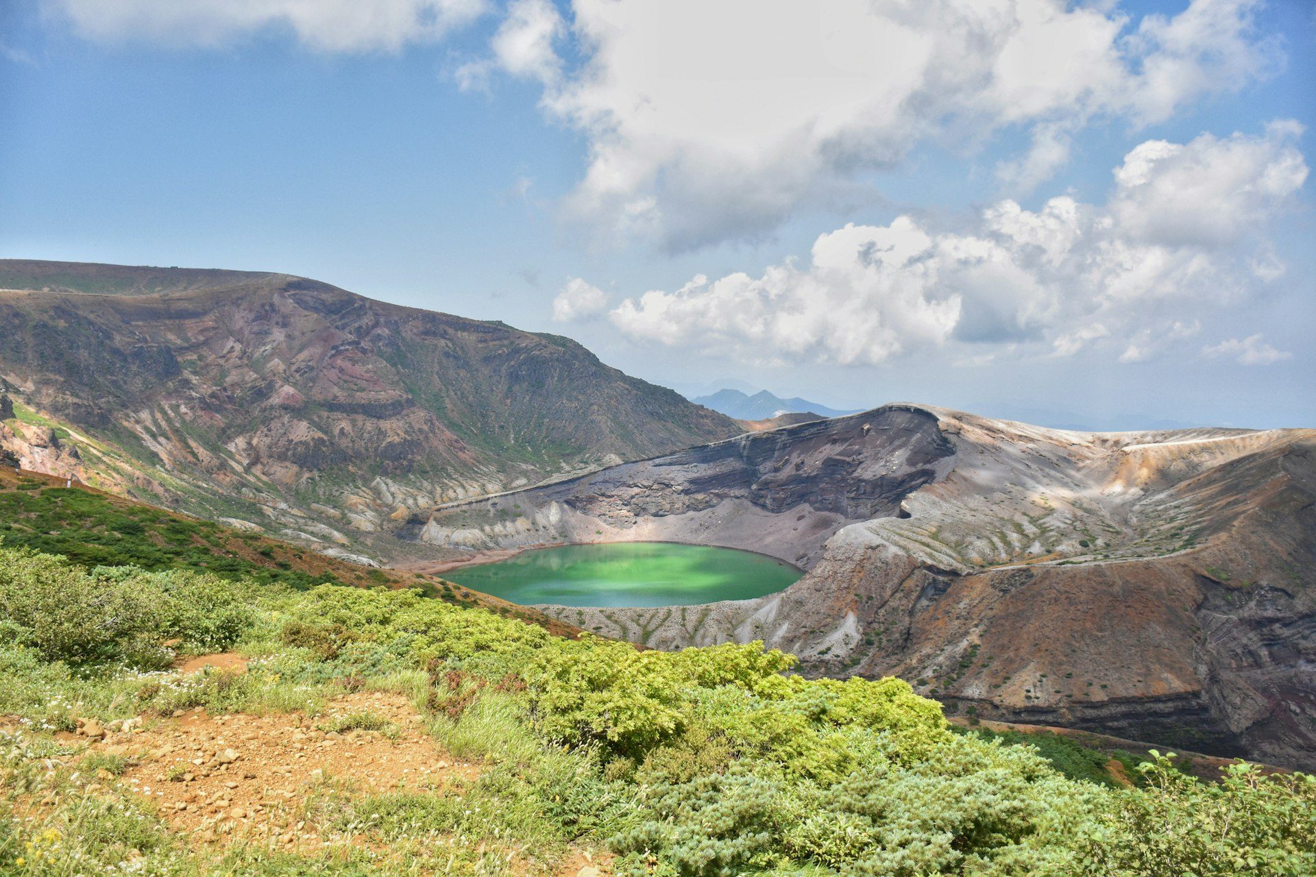
Arriving in Ranomafana feels like entering another world: lush, untouched rainforest. On the first evening, a night walk along the road turned up well-camouflaged chameleons and the tiny mouse lemur. The next morning started early with a 5-hour guided trek through dense jungle in search of endemic insects, reptiles and the rare golden bamboo lemur, which lives nowhere else on earth. Plenty of other lemur species showed up too.
The village itself is charming: tucked into the rainforest near waterfalls, it's a lovely spot for lunch, a stroll, or spotting chameleons hiding in the jackfruit tree.
Ambalavao & Anja Community Reserve
The drive to Ambalavao passes some of the most spectacular highland scenery in the country, and you'll often share the road with herds of zebu, the national animal and the backbone of the Malagasy economy.
Ambalavao is known for traditional crafts. In local workshops, women artisans explain how cocoons from the Tapia forests are turned into rich, textured wild silk. At the paper workshop, tree bark becomes beautiful paper pressed with flowers, a technique that hasn't changed for generations.
The town is surrounded by huge granite peaks, and nearby Anja Community Reserve is the best place to enjoy them. A one-hour guided walk over boulder-strewn paths leads to great viewpoints. The real star, though, is the ring-tailed lemurs sunbathing on the warm rocks, looking like they're doing yoga.
Andringitra Mountains & Tsaranoro Valley
From Ambalavao, the road climbs deeper into the mountains towards the Tsaranoro Valley. The bumpy dirt road is an experience in itself. On market day, it's busy with locals on foot and zebu carts. With scenery like this, it's easy to see why this became one of the highlights of their trip.
The valley has hiking trails for every fitness level. They chose the 7.6 km hike to Chameleon Peak, with 590 m of elevation gain: well marked but still adventurous. The first climb is steep, but you can see the summit the whole way, and it really does look like a chameleon's head. At the top you get a 360-degree view over lichen-covered granite. The descent on the other side ends in the forest at Camp Catta, where ring-tailed lemurs were playing in the trees.
Isalo National Park
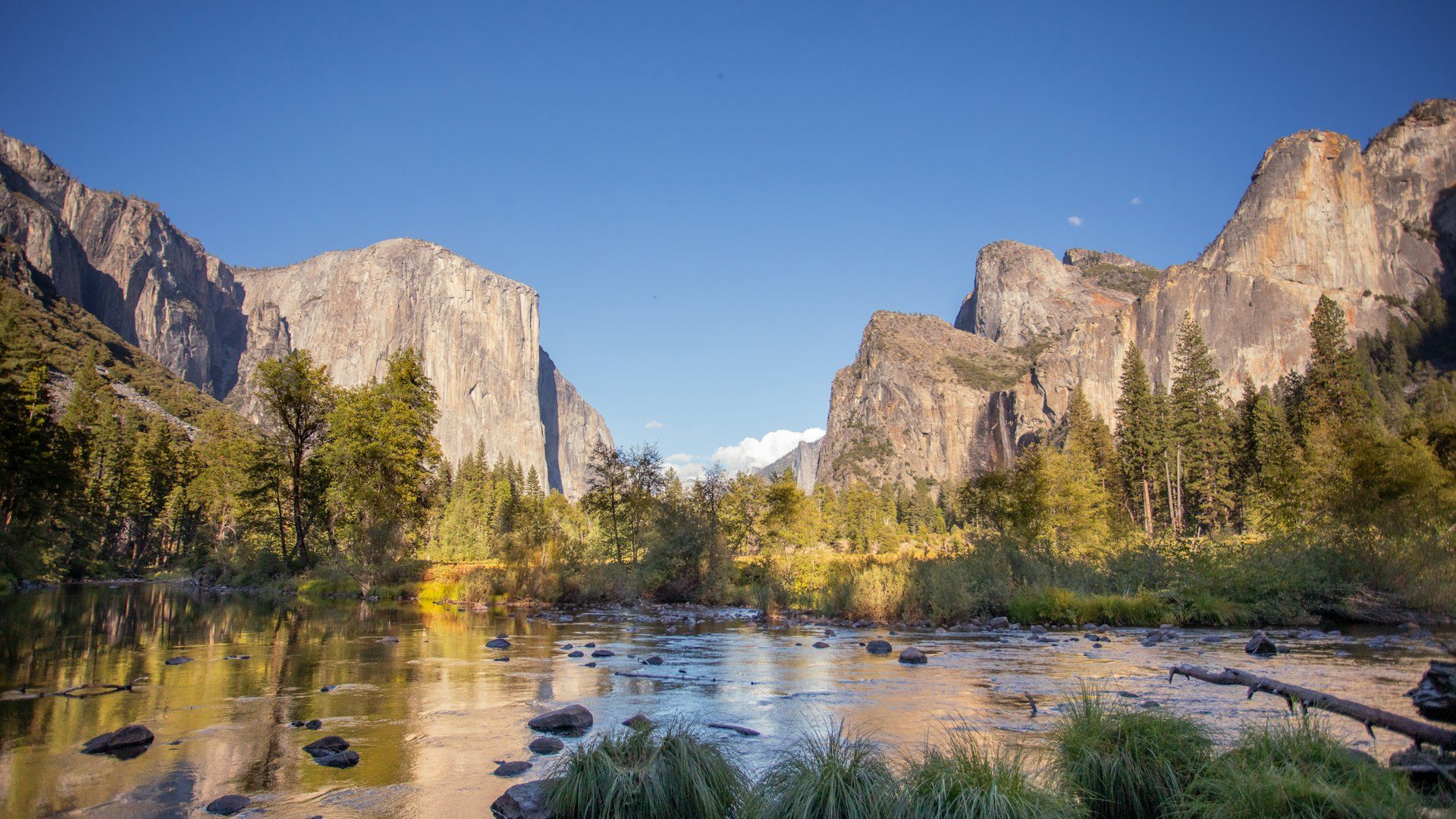
This turned out to be the most beautiful drive of the trip. High plateaus give way to empty grasslands, sandstone massifs and a wide open horizon. After checking in at the Isalo Ranch, they headed to the Isalo Window to watch the sunset through the natural rock arch. Expect company: this is Madagascar's most popular national park.
Plan a full day in the park itself. This dry region is the ancestral land of the Bara people, who traditionally used caves in the mountains as sacred burial sites. A 12 km point-to-point hike crosses golden plains to sun-baked canyons and viewpoints. The best part is the oases along the way: the Piscine Naturelle, the Blue Pool and the Black Pool. Aim to reach the Black Pool around midday for a refreshing (and ice-cold) swim. Afterwards, grab a barbecue lunch at the park's campsite while curious lemurs watch from the trees.
Ifaty & the west coast
On the way to the coast, the land flattens and the first baobabs appear. A stop at a small rum distillery shows how locals turn sugar cane into a strong spirit with very basic equipment.
This stretch also shows the hard reality of the dry south, where water shortages are a daily struggle. It moved the creators to support SEED Madagascar, an organisation that builds sustainable water infrastructure together with local communities. They're donating all the income from their video to its work.
The road ends in Toliara, a fishing hub with a domestic airport. There are several charming beach towns along the coast. A beachfront hotel with fresh seafood and ocean sunsets is the perfect place to recharge. Outside the hotel, the beach can feel a bit overwhelming because of pushy vendors, but a snorkelling or diving trip is a must. On a traditional wooden boat they visited two spots, Massif des Roses and Ankarandava, and had the colourful, healthy reefs almost to themselves.
Only 10–14 days?: End your trip here. Relax on the coast for a few days, then fly back to Tana from Toliara.
Morondava: the road trip becomes an expedition
This is where the real adventure starts. Fill up the tank and bring a spare jerrycan. The first part is on a smooth road, probably the best in the country. But after about 3.5 hours you reach the river crossing at Bevoay. The “ferry” is six canoes tied under a wooden platform, with five men pushing your car across the river. Quite the experience.
After another hour of tarmac you reach the village of Manja. Some travellers stop here for the night. They pushed on in one day, over challenging sandy single-lane tracks through dense bush and shallow river crossings. There are no road signs, so a driver who knows the route by heart is worth his weight in gold.
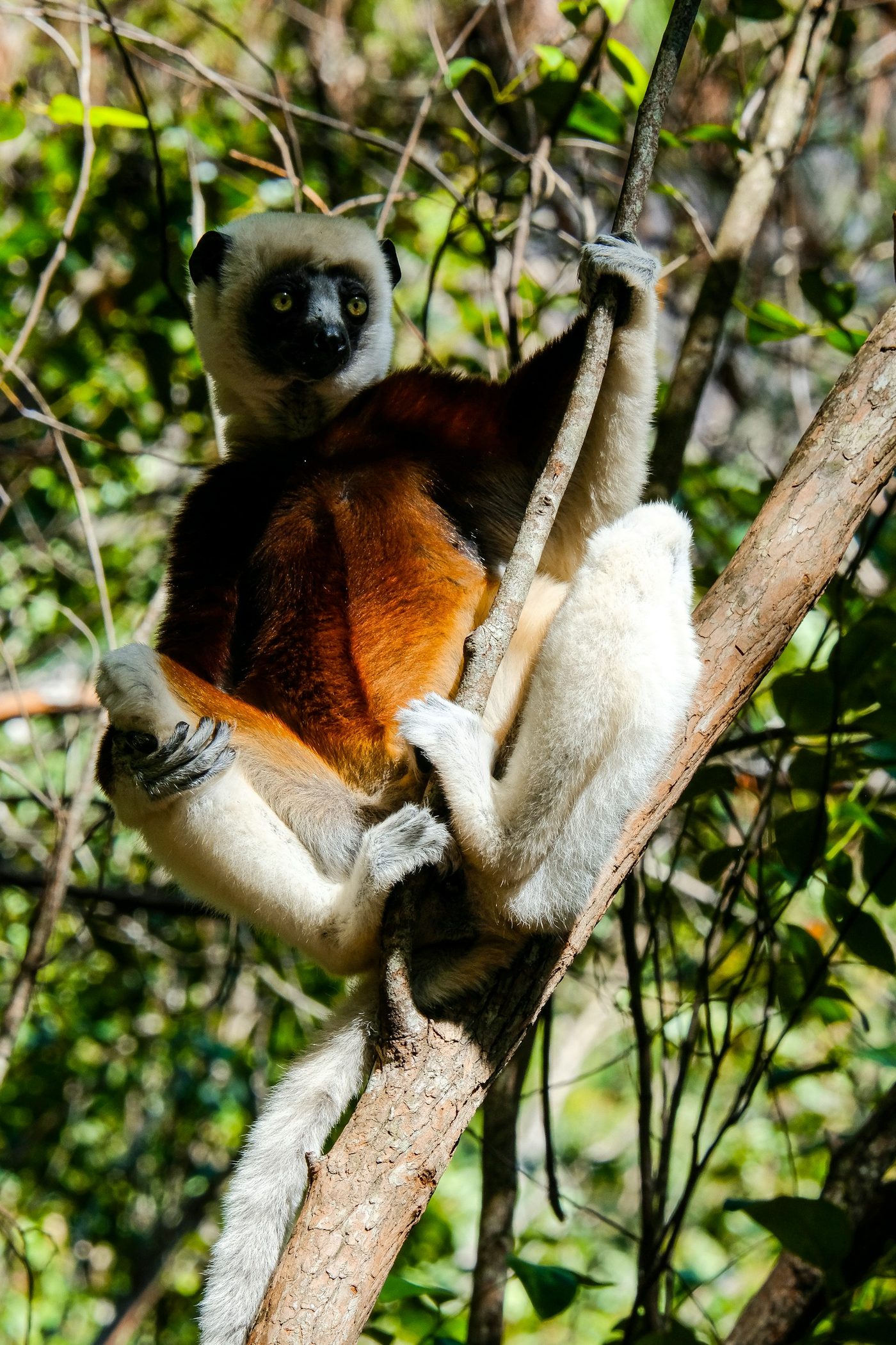
In Morondava, a traditional pirogue takes you to the fishing village of Betania. You'll see how the fishermen live, how they build their own boats, and, if you're lucky, how they climb towering palms to pick fresh coconuts. The town itself has a relaxed coastal feel, great fish dishes and a long sandy beach. At a small dry-forest reserve nearby you can see its tortoise conservation work and spot wild sifakas in the treetops.
“Travelling in Madagascar is never just a way to get from A to B. It's the heart of the adventure.” — from their video
Baobab Avenue & Kirindy Forest
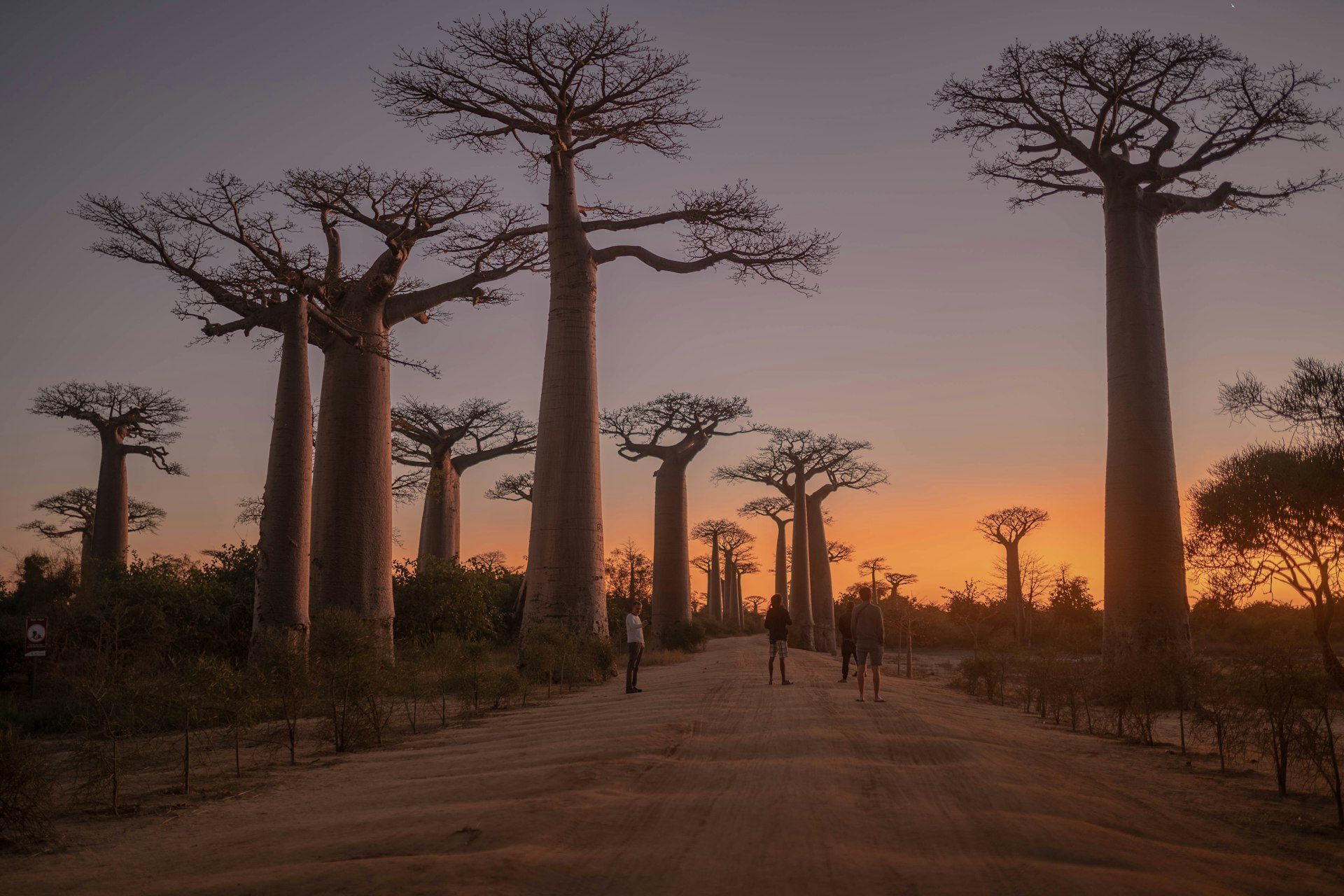
Just 45 minutes from Morondava is the world-famous Avenue of the Baobabs, Madagascar's most iconic sight. These giants grow up to 30 metres tall. You'll probably pass them twice: on the way to Kirindy and again on the way back from the Tsingy. During the day it's quiet, but at sunset tour buses arrive from Morondava. Even with the crowds, the silhouettes against the evening sky are worth it.
Another 1.5 hours further lies Kirindy Forest. The terrain is flat and easy to walk, making it a great place for lemur spotting. On the night walk they saw fork-marked lemurs, grey mouse lemurs and red-tailed sportive lemurs. During the day there were plenty of sifakas and red-fronted lemurs. The one animal that stayed hidden was the elusive fossa, Kirindy's most famous resident. Keep your eyes open!
Tsingy de Bemaraha National Park
The drive to the Tsingy was the toughest yet: eight hours on dusty, rutted tracks, broken up by a scenic one-hour ferry crossing. Around lunchtime you reach Belo sur Tsiribihina, home to Mad Zebu, a surprising restaurant run by a Malagasy chef who swapped fine dining in France for the middle of the wilderness. A perfect stop before the last stretch, where you may see other cars being pulled out of the mud by locals.
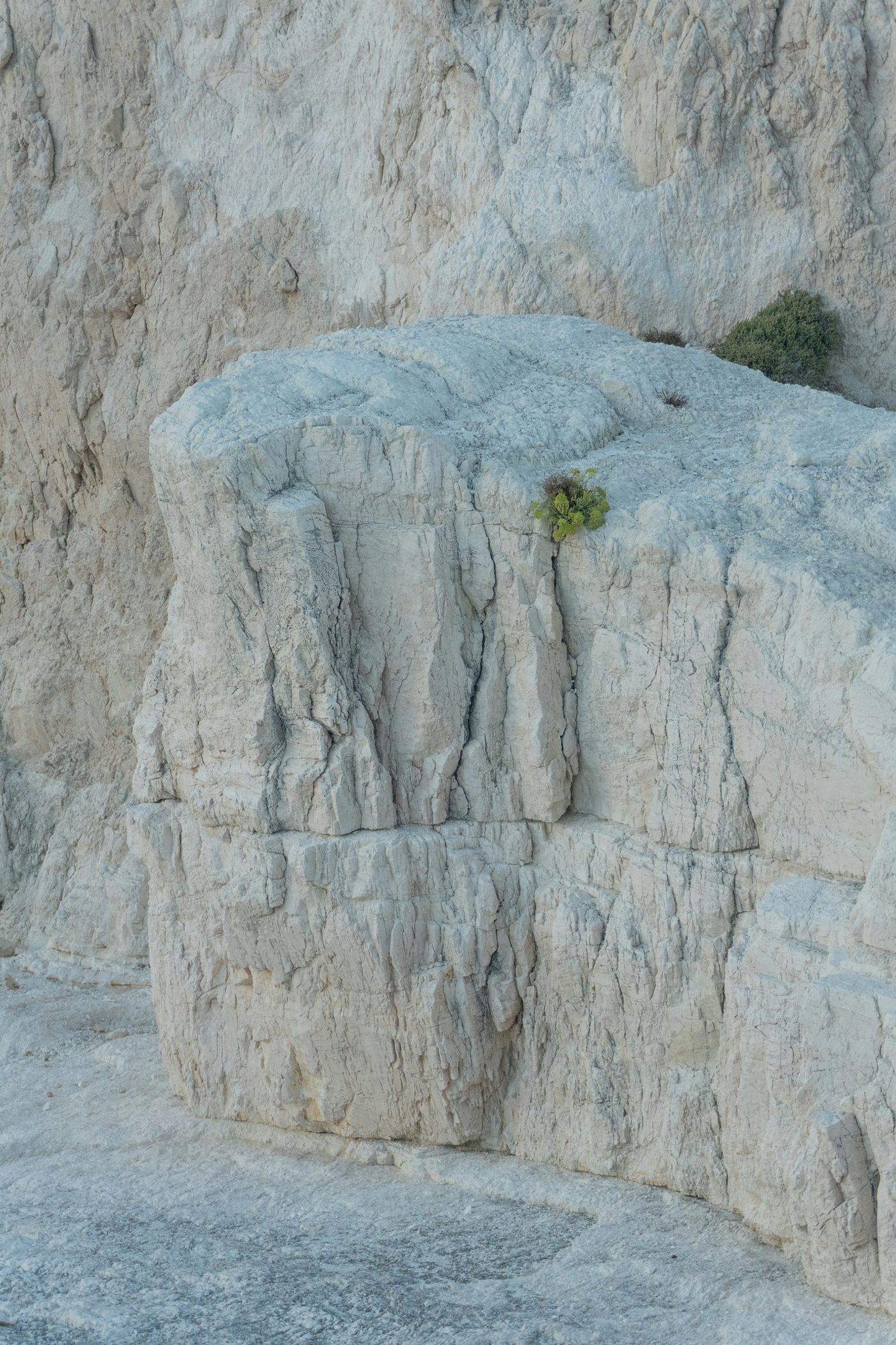
One final short river crossing brings you to Bekopaka, the gateway to the Tsingy. Day one: an hour-long boat trip past dramatic limestone cliffs and hidden caves, followed by an easy walk through the Petit Tsingy, a gentle introduction with limestone passages and clusters of weathered pinnacles.
Day two is the big one. After an hour's bumpy drive to the trailhead of the Grand Tsingy, you strap on a climbing harness. The roughly 3.5 km route winds through caves and narrow gorges, up via ferrata rungs and ladders, and across a suspension bridge high above the ravines. Take your time: including the shady forest trail back, the loop took about four hours, and it was one of the absolute highlights of the trip.
The way back & stops to add if you have more time
The return to Antananarivo was the hardest part of the trip: ten hours just to get back to Morondava, followed by another long drive via Miandrivazo and Antsirabe. Their honest advice: fly from Morondava back to the capital and save yourself days of tiring travel.
Got extra time? Two more places they recommend:
- Andasibe is home to some of the island's most beautiful rainforest and the famous indri, the largest lemur. It's an easy detour from Tana, but plan at least three extra days.
- Nosy Be is the place for a tropical island break. It lies off the north coast, so you'll need a domestic flight to and from Tana.
Practical tips for your Madagascar road trip
- Take your time. Distances look short on the map, but potholes, dirt roads and river crossings make drives take much longer.
- Travel with a local driver/guide. Many routes have no road signs, and local knowledge makes all the difference, on the road and in conversation.
- Bring cash. Not every ATM works, so sort out cash on your first day in Tana.
- Carry extra fuel on remote stretches such as the route to Morondava.
- Use domestic flights smartly. Toliara and Morondava both have airports, so you can skip the long drive back.
- Hire local guides in parks and reserves. It's often required, and they spot wildlife you would walk right past.
- Pack for everything: rainforest, cold highland evenings, desert heat, swimming pools and a via ferrata.
Planning your own Madagascar road trip? Start with the route above, give yourself more time than the map suggests, and book a local driver who knows the roads.